Mesoflow
Marine Channel Splashboard
Real-Time Data
For Safe Channel Operations
For Safe Channel Operations
Know the Conditions to Plan Your Voyage
Real-time & forecast water levels, currents, and meteorological data—for every pilot decision
The Challenge
To make safe navigation decisions, pilots and mariners need real-time data and forecasts about the environmental conditions of the ship channel. Manually searching many different websites is time-consuming and unreliable. Navigation safety and ship efficiency are reduced when data is incomplete or delayed.
The Solution
Build a data dashboard to aggregate ocean and atmospheric real-time data and forecast models into actionable channel information. Every pilot in your association gets live water levels, currents, wind and weather alerts—all customized for YOUR ship channel.
About Mesoflow
Former NOAA oceanographers who understand near-shore dynamics. Real-time NOAA data (proven science, not experiments). Purpose-built for maritime operations. We are the oceanographers who installed and built CO-OPS navigation products.
Advantages
vs. Manual Monitoring: Real-time automated data at your fingertips
vs. NOAA PORTS: Customized NOAA data increasing operational focus for marine pilots + data aggregated from USGS, BOEM, NASA ...
vs. In-House Systems: Proven science built in, no IT burden
Every pilot using the same dashboard. No guesswork.
Knowing the environment: Increases safety and efficiency.
vs. NOAA PORTS: Customized NOAA data increasing operational focus for marine pilots + data aggregated from USGS, BOEM, NASA ...
vs. In-House Systems: Proven science built in, no IT burden
Every pilot using the same dashboard. No guesswork.
Knowing the environment: Increases safety and efficiency.
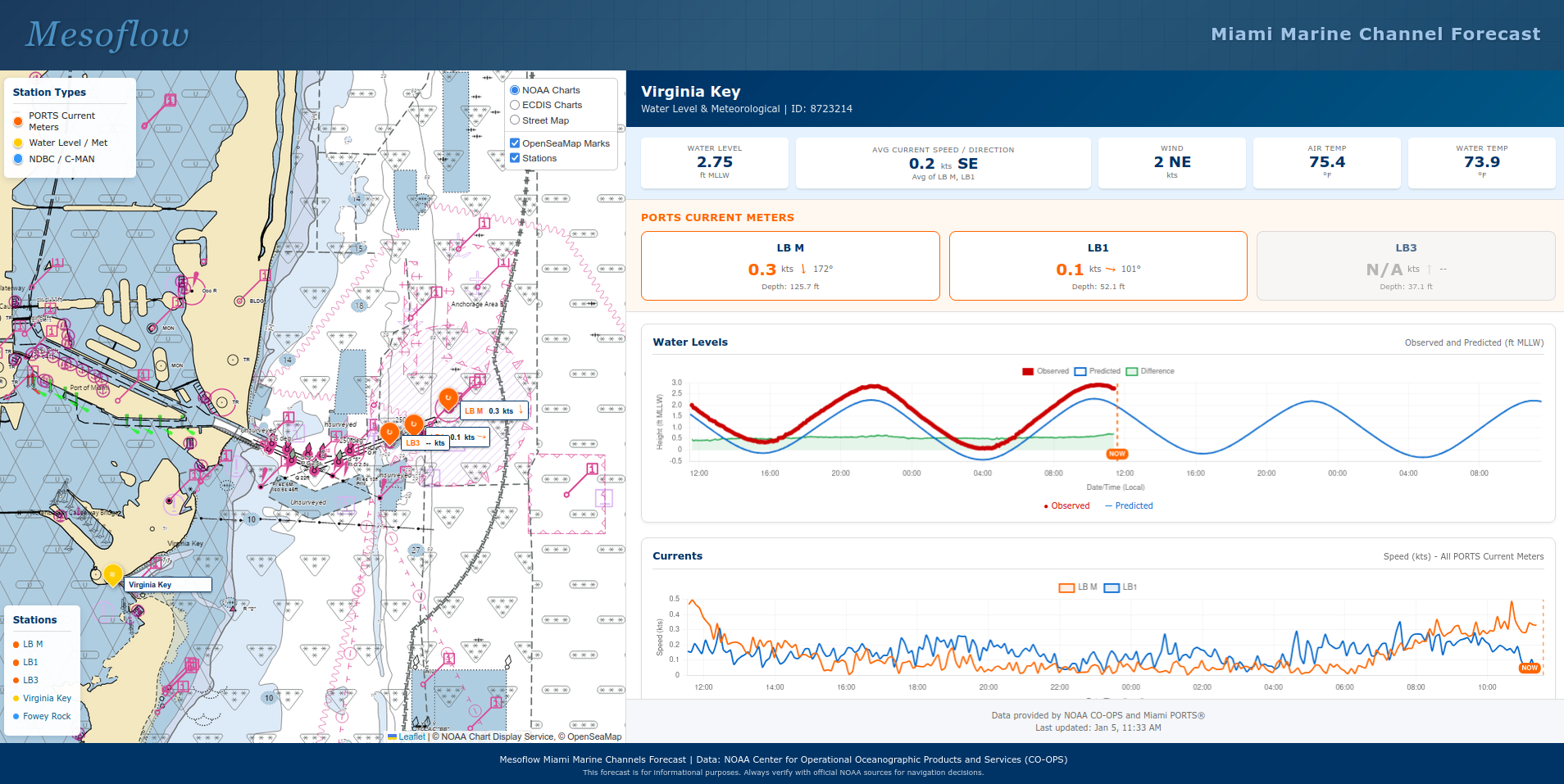
Dashboard Features
Real-time data every 6 minutes
Tidal & current predictions
Wave & wind data
Storm surge alerts
Mobile access (bridge, office, home)
Synthesized model forecasts
Interested in a Customized Navigation Dashboard?
Free Assessment: Analysis of YOUR pilot association's specific needs
Email: info@mesoflow.com | Website: https://mesoflow.com
Request Free Assessment
Email: info@mesoflow.com | Website: https://mesoflow.com